
Identify every project neighbour
in minutes, not weeks.
Accelerate community engagement with accurate, verified neighbour mapping. Ensure no impacted neighbours are missed.
Accurately identifying and engaging neighbouring residents around energy infrastructure projects is critical; failures can lead to project delays. Yet many projects still rely on manual GIS processes that take weeks and can result in missed neighbours and late-stage objections.
Reswitch Neighbour Mapping replaces this manual process with accurate, verified neighbour identification, ensuring every impacted neighbour is identified quickly and confidently.
Faster engagement, no missed neighbours, and stronger social licence.
Reswitch has developed a specialised mapping capability designed specifically for wind farms, solar farms, battery projects and transmission infrastructure.
The result is a verified neighbour dataset ready for community engagement.

Automated Mapping Collation
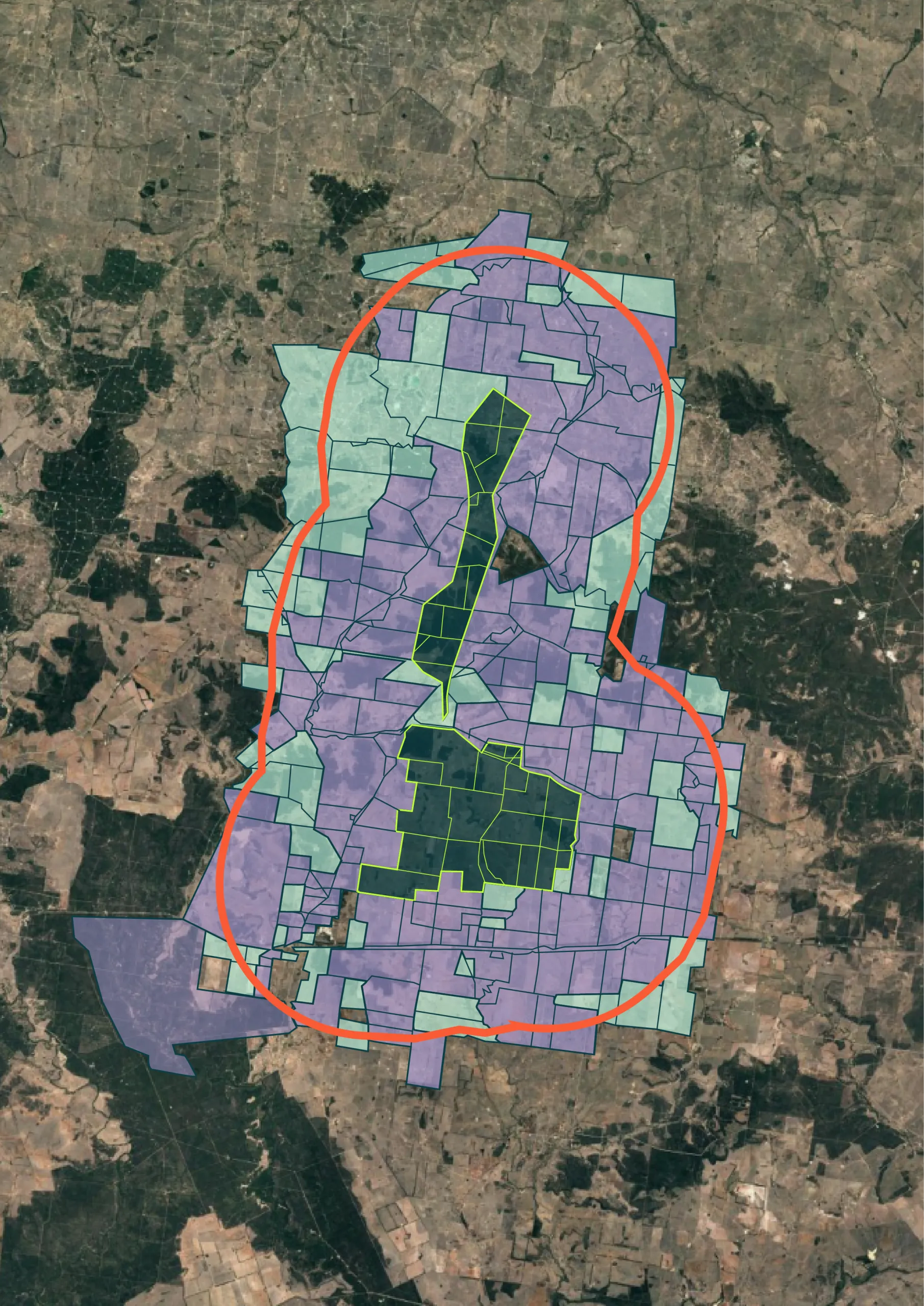
We aggregate cadastral, title, and address data from multiple authoritative sources to build a complete picture of every dwelling within your project's neighbour zone.
- ✓Multiple cadastral data sources
- ✓Title and address cross-referencing
- ✓Distance-band classification
Manual Verification of Dwellings
Every dataset is reviewed by our team to catch edge cases, boundary anomalies, and data gaps before delivery — so you're never working from an incomplete list.
- ✓Human QA review on every project
- ✓Edge case and boundary resolution
- ✓Gap identification and correction
Interactive Mapping Dashboard
Visualise your project's neighbour zone on an interactive map. Explore by distance band, LGA, and eligibility criteria before exporting.
- ✓Distance-based filtering
- ✓LGA and council breakdowns
- ✓Shareable and exportable views
Downloadable Data for Your Systems
Receive your verified neighbour dataset in formats ready for GIS platforms, CRM systems, and community engagement tools.
- ✓CSV and GIS-ready formats
- ✓CRM-compatible export
- ✓Ongoing update delivery available
What you receive.
Every neighbour mapping engagement includes a complete set of verified data and supporting files. Ready to use immediately in community engagement and project planning.
- Verified Neighbour Dataset — every dwelling within your nominated zone
- GIS Project Files — compatible with QGIS, ArcGIS, and MapInfo
- Address and Title Verification Report — audit trail of data sources
Know your neighbours before you need to.
Get in touch to discuss your project's neighbour mapping requirements.